
truestar inc. polygon and population statistics every five year
Summary
This dataset includes the Japanese subregional polygon data, which is edited by truestar based on the subregional boundary data of the national census 2015 and 2020. We integrated the data from the statistics of subregional arrogated data.
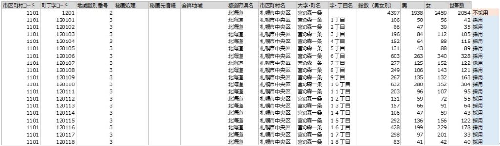
Sample Data
Features/Usages
We combined the polygon data and aggregated numerical data to make it one record per town record. This makes easier to match with the statistic data of the national census 2015. This dataset already includes the basic data such as population or the number of households. You can analyze the trading area by street and visualize it easily.
In addition, you can also share the data by geography type and do the mapping easily by using the BI or GIS tools. In general, when you use the population statistics provided in the open data, the subregional dataset is too large and often difficult to deal with.
However, by sharing the edited dataset, we can make the trading area analysis more effectively and speedy.
Speaking of the data of 2020, we provide the data without polygon data antecedently.
Data Fields
| RESEARCH_YEAR |
| ADDRESS_CODE |
| PREF_CODE |
| PREF_NAME |
| PREF_CODE_NAME |
| CITY_CODE |
| CITY_NAME |
| CITY_CODE_NAME |
| STREET_CODE |
| STREET_NAME |
| STREET_NAME1 |
| STREET_NAME2 |
| STREET_CODE_NAME |
| LONGITUDE |
| LATITUDE |
| INCLUDED_IN_AREA_CODE |
| INCLUDING_AREA_CODES |
| POPULATION |
| POPULATION_MALE |
| POPULATION_FEMALE |
| NUMBER_OF_HOUSEHOLD |
| AVERAGE_AGE |
| POINT_JP_STREET |
| POLYGON_JP_STREET |
References
- 2020
- 2015
Edited by truestar based on the national census 2020 provided by e-Stat (Japanese Government Statistics)
https://www.e-stat.go.jp/stat-search/files?page=1&toukei=00200521&tstat=000001136464&cycle=0&tclass1=000001136472
subregional aggregated data
https://www.e-stat.go.jp/gis/statmap-search?page=1&type=2&aggregateUnitForBoundary=A&toukeiCode=00200521&toukeiYear=2020&serveyId=A002005212020&datum=2000
subregional boundary data
Edited by truestar based on the following data:
the national census 2015 provided by e-Stat (Japanese Government Statistics)
https://www.e-stat.go.jp/gis/statmap-search?page=1&type=2&aggregateUnitForBoundary=A&toukeiCode=00200521&toukeiYear=2015&serveyId=A002005212015&datum=2000
subregional boundary data
https://www.e-stat.go.jp/stat-search/database?page=1&toukei=00200521&tstat=000001080615
subregional aggregated data
Special Notes
※About processing of sub-regional data
Based on the statistics held by the original data, we would determine whether the records are held at the “Ooaza/Town” level or at the “Aza/Chome” level to carry out necessary processing so that the polygon becomes a single record at the adopted granularity.
The three basic logic patterns are
1/ When there are no records of “Aza/Chome” level in the original data

Adopt records at the “Ooaza/Town” level since no data at “Aza/Chome” level is available
2/ When there exist records of “Ji/Chome” level with statistics in the original data
Adopted: records at the “Aza/Chome” level
Rejected: because records at the “Aza/Chome” level exist
3/ When there exist records of “Aza/Chome” level in the original data, however statistics are not available in this level

Adopted: records at the “Aza/Chome” level without statistics ⇒ apply polygon integration
Rejected: records at the “Ooaza/Town” level are adopted due to lack of statistics in “Aza/Chome” level
Update History
- 2022/1/28 : Rename JAPAN_STREET_FUNDAMENTAL_DATA to STREET_00_FUNDAMENTAL
- 2022/1/28 : Rename column NUMBER_OF_HOUSEHOLD to NUMBER_OF_HOUSEHOLDS
- 2022/4/1 : STREET_00_FUNDAMENTAL_BETA
- 2022/7/12 : Add polygon and point data on STREET_00_FUNDAMENTAL_BETA and rename to STREET_00_FUNDAMENTAL_2020
- 2022/7/29 : Release STREET_00_FUNDAMETAL_2020
- 2022/7/29 : Rename STREET_00_FUNDAMENTAL to STREET_00_FUNDAMENTAL_2015